Quote

“It is good to have an end to journey toward; but it is the journey that matters, in the end.” ― Ernest Hemingway

Translate

Showing posts with label waterfall. Show all posts

7 August 2015

Broome – Perth Road trip: Karijini National Park

Dales Gorge, Karijini NP

Thursday 28th May 2015

     The temperamental weather of the previous day dissipated and we were finally able to see what all the fuss over this national park was about. Karijini covers an area of around 1,500,000 acres so you need at least three good days to make the most of it.

    We headed to a spot a few kilometres east of the visitors centre with a few short walks to wake up our legs which had been taking it easy for a while. The walks are all graded on difficulty so even people with limited mobility can pick the trail which suits them. The only place where the rangers seem to get it wrong is with the estimated time the walks should take. The first lookout was only 500m away, yet the sign stated a twenty minute return. COME ON! I don’t know how much dawdling Australian tourists do but I’m pretty sure most people could beat that time even if they were spun around until dizzy, told to walk backwards and had their shoelaces tied together. In fact make it a new game. If you go to Karijini or any national park in Australia for that matter. Try and see who can get the closest to the estimated time to complete a trail and while you do it act like you’re walking normally. I bet you end up getting right weird looks from other hikers as you waddle like a severely constipated penguin.
What a Gorge-ous pair
     Naturally we opted for the toughest one on the list which was only a medium difficulty trail (3km so probably advised to give a fortnight to complete). Nothing too challenging but it would require some clambering and climbing over slippery rocks. The first phase took us via a number of viewpoints of Dales Gorge and even on a slightly muggy morning the view was incredible. The lush vegetated, rolling hills and troughs suddenly give way to the immense cliff faces of banded iron with the odd blue white vein of asbestos. Wandering down the canyon wall for a few hundred meters we reached the river and in a landscape such as this that meant waterfalls. Fortesque Falls isn’t the most spectacular we have seen but at least the contrast between orange rock and the crystal clear liquid was pleasing on the eye. It’s a shame the sun never showed itself as I think that would have amplified the view tenfold. None the less this didn’t dampen Jono’s spirits and as I tried to find a good view for a photo he took and much needed swim in the freezing water.  
Fortesque Falls
     Beyond the falls is the aptly named Fern Pool. The still pond is another great swimming spot made nicer by the lush plant life and overhanging paper bark trees. The paper bark trees seem to sprout directly out of the bedrock and due to the enclosed surroundings some acquire some unusual stances. Like many of the trees in this part of the world the bark peels off over time to encourage passing bush fires. Unlike the commonly seen eucalyptus however the paper bark can be peeled off in sheets, hence the name. We collected some bark as it would provide good tinder to get a fire going in the damp weather. All I need now is a decent knife, a desire to drink my own urine and legal document changing my name to Wolf Grinz and who knows I might just get my own TV show.
Paper bark tree

All in all a good day well spent.   

Friday 29th May 2015

     Once again sods law prevailed in double measure as even by our standards it properly pissed it down. With the nearest petrol station in Tom Price on the other side of the National Park every decision to leave the camp was a calculated one and with no prospect of a nice walk we decided to have a lazy day and sit tight. Naturally our food and beer supply took and beating but at least with the free Wi-Fi we were able to check the forecast for the next few days and it predicted a noticeable improvement.
Fern Pool

Saturday 30th May 2015

     Thankfully the weather people were right and the weekend brought the sun out. We left the free camp site behind and headed to the visitor centre hoping that we would be able to get into the heart of the park. It seemed luck was on our side and the gravel track had been reopened to the public. Many of the visitors had decent 4x4 vehicles which could tackle the trails no problem but despite our optimism Dave and Dustin assured us that they have driven their two wheel drives along much worst roads. Naturally this discussion meant we had tempted fate and 800m along the track Dustin’s Ford Falcon (which we were in) had a puncture. Normally this wouldn’t be a big issue but as you will recall Dustin had been trying to find a cheap spare a few days prior as his one already suffered from a slow puncture. Sadly there was little option but to use the slightly hampered spare until we could get a replacement. The cost of recovering a car out here is not worth thinking about unless you are a lottery winner so very tentatively we crept along with our fingers crossed until we reached the next bunch of sights 25km away.

The consequence of wacky races

     Hampered by the puncture we focussed on a number of quick viewpoints and photo spots close to the road and car parks. This would mean an overnight stop at the pay to stay eco lodge but at least it would give us a full day to do some decent hiking. Like the gorge on Friday all the viewpoints are spectacular with their own characteristics. Joffre Gorge was the highlight with its large waterfall tumbling over the polished banded iron staircase but there are also viewpoints of Knox Gorge and the four canyon junction (Joffre, Hancock, Red and Weang).


Left to Right: Jono, Ross, Bastiaan, Dave and Dustin     
     As evening set in we booked in at the “Eco Retreat” on the opposite side of Joffre Gorge to the viewpoint. The fee was $20 per person/night for an unpowered tent site meaning as a group we would have to pay $100. As we were trying to do this road trip on a budget it seemed a bit of a piss take. Sure the funds apparently go towards maintaining the park, but really how much maintenance does a geological landscape like this need? It’s been relatively unaltered for millennia and I didn’t see any park rangers cleaning mildew off every rock with a tooth brush. Despite the fee it is still the visitor’s responsibility to clean up and dispose of rubbish so really they were providing the same facilities as the free camp site we had stayed. Being the sneaky, money dodging backpackers we are we hatched a cunning plan. Dave and Dustin dropped myself, Jono and Bastiaan just inside the entrance and checked in the cars whilst we mingled around the grounds. After twenty minutes we regrouped and split the now $40 fee between us. It was an immaculately conceived hustle and unsurprisingly the “planet saving” rangers couldn't even muster the energy to unravel our scheme. Mostly because they were distracted by the hordes of grey nomads with pensions burning a hole in their pocket, buying stubby’s (an aluminium can in the Queen’s English. Oh yeah and that’s pronounced “alu-minium”, not “a-loo-min-um”) of piss (lager) for $13 a pop.

Sunday 31st May 2015

     After making the most of the Eco Retreats warm showers and still reeling over the con we headed out early to make the most of our last day in this wonderful geological oasis. Before leaving the camp site we returned to Joffre gorge on foot and climbed down the canyon side to reach the pools at the base of the waterfall. The cool waters were offered rest bite from the day’s heat which even in the morning was well on its way to hit the mid 30’s. Weirdly enough some of the Aussies had packed thermal wetsuits to brave the waters. I'm sure the concept of snow must seem like the beginning of the apocalypse to folk that think temperatures in the low 20’s means donning a woolly hat.

Joffre Gorge Falls

    North of the falls is Weano gorge and more viewpoints and trails. Once you descend into the Weano valley there is a great walk to the handrail pool which as the name suggests is a river walk culminating in a handrail trail leading to a waterfall. It was more of a swim than a walk but definitely worth the effort as it offers some great photo opportunities. Next on the list was Hancock Gorge which runs adjacent to Weano Gorge where the walk takes you to Kermit’s Pool.
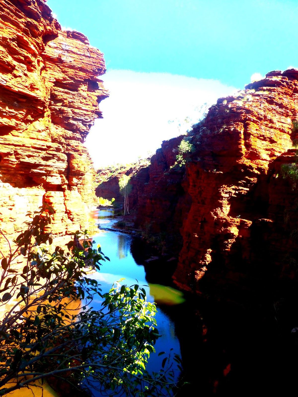
Weano Gorge
     
    We spent as much time as we dared in the park before heading towards Tom Price. Our calculations had been almost perfect as Dustin’s car ran out of fuel a few miles out of town but after syphoning some from Dave’s Honda Getz we got to a garage eventually.


     Our overnight spot was at a place called halfway bridge just outside Tom Price. It was a nice free camp site right on the river (although it was too dark to see) and there were already a few travellers setting up. We shared tea with a nice couple who lived on the road in a converted ex-military bus. They were really taking the easy rider, hippie lifestyle to the extreme earning cash as mobile hairdressers and even educating their kids on the road only returning them to school when exams are due. “I gave the kids a choice to either learn concepts and theories about language, politics, mathematics, geography and life skills in a classroom or go out into the world and experience it first-hand…. They chose the latter” he said whilst sucking on an incredibly aromatic cigarette. As eccentric as they seemed if you sit down and think about it most 9 year old's would do the same thing and it should be encouraged. If you look back I bet most of you wanted to be explorers, astronauts or pirates but the reality of later life distracts you from that desire to witness new things. 

Larry the lizard

Useful Links
8 February 2015

Cameron Highlanders

16th - 20th January 2015

     We left Ipoh for the Cameron Highlands in convoy with a fellow countryman Oliver Hamler who had been couchsurfing with us at Bella's place. The three hour bus journey along the winding mountain highways was a smooth one until we reached a police checkpoint. The officers boarded the bus armed with guns and in an intimidating tone ordered us to "show our passports". Naturally we quickly responded to this request and waited for the officer to reach us. Unusually he had no interest in the passports of any "Westerners" and a little interrogating he ordered almost half the bus to head outside to the checkpoint desk at which point the bus continued on its way. We later found out that the region has been hit hard by illegal deforestation and agriculture from mostly Bangladeshi and Burmese immigrants looking to take advantage of increased salaries. As a result the Malay government has clamped down on any individuals looking for work without the proper documentation.
Who said we've passed our peak

Mossy Forest
Malaysian Pitcher Plant waiting to catch some insects
    

      Despite the eventful journey we made it to Tanah Rata in one piece. Tanah Rata is the main town in the Cameron Highlands and is therefore the main commercial hub for the area with plenty of hotels, hostels, restaurants and stores. We booked four nights at Fathers Guesthouse, one of the highest rated hostels in town due to the friendly atmosphere and the great treks they offer.


Our band of backpackers

   Its all about the trekking and the tea in the Cameron's and on our first full day we arranged to join a 4 hour guided hike up one of the nearer peaks. Our guide Jason was a wealth of knowledge regarding the local flora and fauna, particularly when it came to the wild orchids. Unlike our other short hikes this was real jungle and its easy to see how people can become disorientated moving through the slightly claustrophobic web of roots and branches. The sightings of animals was limited to a few birds and one non toxic viper but that didn't really matter to us because for once we were able to feel like proper explorers of old.


Indiana Bones is back

this is more like it. where's that machete

     The jungles of the Cameron's are known as the "mossy forests" due to the abundance of tree hugging mosses. These sponge like plants are critical to much of the life that's evolved and many species are only found in this part of the world. From the peak of the mountain we had a great view of the valley below and a lunch break of much needed nutella sandwiches before heading toward the plantation. If I had known about the nutella and tea I would have tried this trekking lark a long time ago.


      As we approached the tea plantation we saw first hand the stark contrast from the thick mossy forest and the scorched earth from land clearance. However we were now left in awe of one of the most beautiful man-made landscapes around. The sweeping carpet of green leaved terraces stretched out as far as the eye could see and it was spectacular. The plantation shop signaled our finish line and being English we took great delight in celebrating with a finest and freshest cup of tea you can find with a view over the valley.


conditions change quickly here


thanks for the free parking
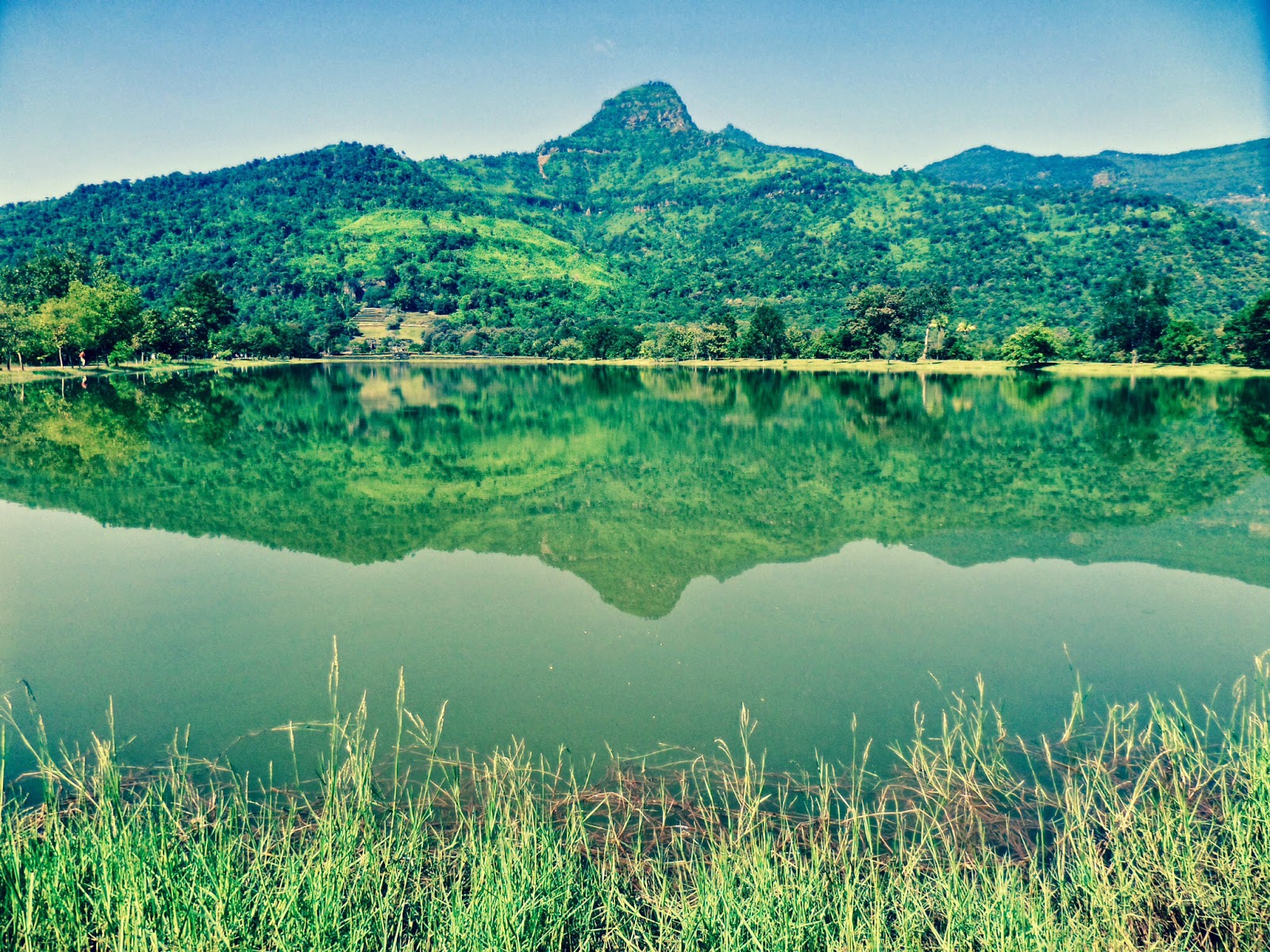
     Our second trek attempt came two days later where we planned to head out of Tanah Rata towards the town of Brinchang. The trek would be fine to complete on our own as long as we followed the trail. Like our first trek we decided to hike uphill through mossy forest for around 2 hours to reach a radio tower at the peak. From there it would be a longer gradual descent back to town through another plantation. This was a tougher hike than the first as it was uphill all the way but after just over two hours we made it to the top with a few scraped knees and a real bad case of sweat rot. The funny thing is by hitchhiking back and walking up we saved ourselves almost £20 compared to the guided tour which took tourists to the top by land rover, meaning they missed the jungle all together.


A stunning walk down to town through the plantations
    

look out KL were coming for you next
     As we leave the cool climate of the Cameron's behind and travel to the Malaysian capital of Kuala Lumpur we are left with a sad truth. Sadly much of this unique habitat is being destroyed at an alarming rate due to deforestation for tea plantations and increasing temperature due to air pollution. Unfortunately the Cameron Highlands do not yet have national park status and therefore lack sufficient environmental protection policies. Hard efforts from local conservationists like Jason have fallen on deaf ears as many lack the education to understand that losing the jungle will mean huge long term consequences including a decrease in soil nutrition, increased run off and risk of regular landslides. The effects of recent landslides during an unusually wet December 2014 still scarred the landscape.

     Once again government corruption does little to help the situation with many officials to focused on short term monetary gains to care about the consequences for future generations. So for us it was a real privilege to explore a beautiful environment that is likely to die out in the next fifty to one hundred years and become just another notch on the long list of victims of mankind.

      Right serious article over and I promise the next post will be of a lighter nature and contain a picture of a cat or something.

28 December 2014

Luang Prabang: The cultural capital of Laos

1st - 4th December 2014

Everything has positives and negatives and backpacking is no exception and the main curse of travel is making friends, wandering as a group and then just as abruptly waving goodbye and wishing them a safe journey. It's been a regular feature since leaving the UK and sadly Vang Vieng was where we said farewell to Will "the beard" Dadson (if you ever take up professional darts you can keep the name). We'll see ya in OZ mate and Jono will get a few beers in.

As Will turned back south towards Cambodia we pressed on North to rejoin the Mekong at Luang Prabang. The ride was a little cramped but the scenery was spectacular. The winding mountain roads act like artificial arteries through the rough terrain and increasingly thicker vegetation. Every so often we would pass an isolated village or glimpse an awesome valley view.

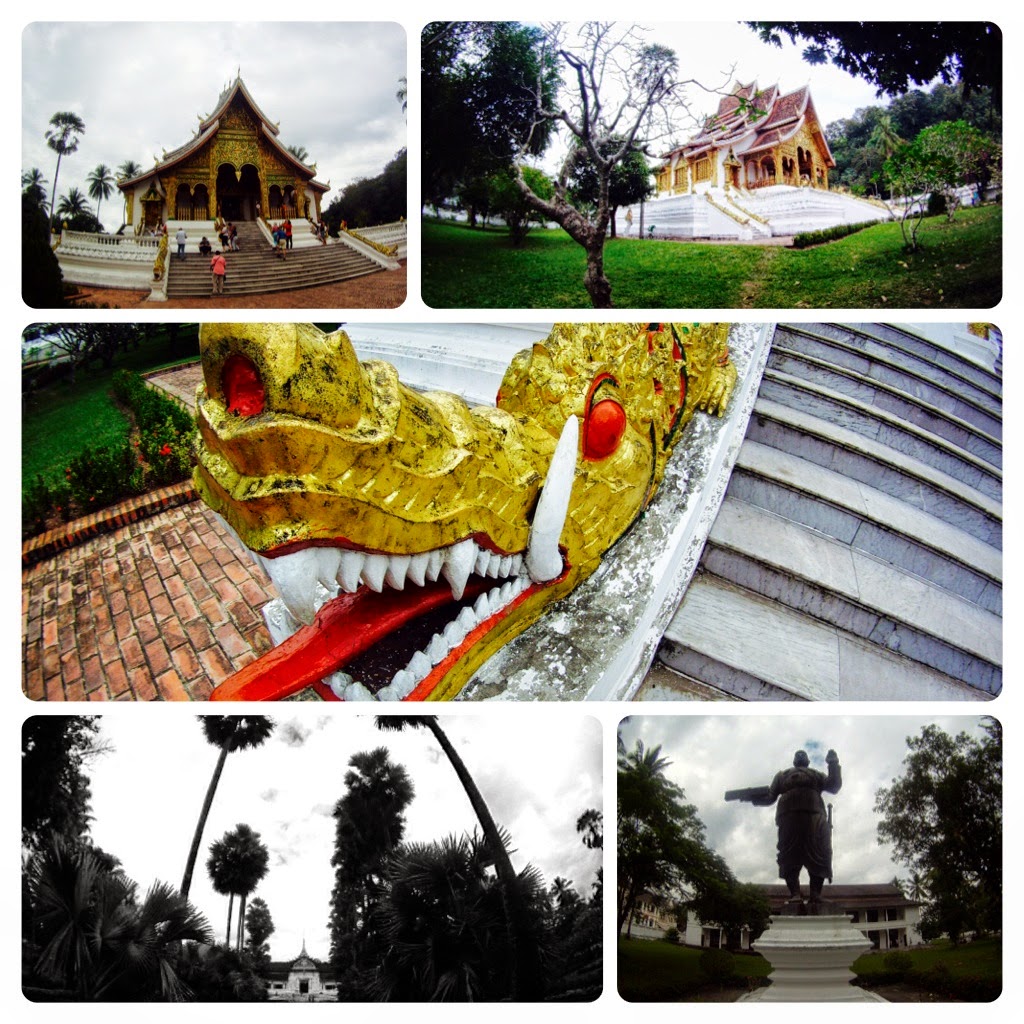
Luang Prabangs Royal Palace

We arrived in Luang Prabang around mid afternoon and were immediately met by the hustle and bustle of a popular tourist destination. Our first priority as always was to find a place to stay. There are an overwhelming number of guesthouses in Luang Prabang for the size of the place and thankfully for us one of our fellow passengers Garbie helped narrow down our search. Our friendly Australian guide had visited the town before and kindly led us to "Sisombath House". A short walk from the centre Sisombath housed cozy dorm rooms with warm showers and breakfast included for 40,000 kip (£3.50) per night. The guesthouse also had a cool chill out area although the wifi is naff.

Luang Prabang is a lovely town with history, culture and wonderful natural sights and vibrant markets all rolled into a small area. Despite being very touristic the place still retains a chilled atmosphere synonymous with Laos. All the sights in town are located in the centre. Visit the royal palace during the day, climb mount Phousi for the sunset and grab a cheap meal in the night market in the evening (all you can eat buffet for 15,000 kip that's £1.20).
The drinking scene is laid back with he bars closing at 11:30pm leaving the bowling alley as the only late night venue with alcohol available late into the night. Check out "Utopia Bar" on the banks of a tributary to the Mekong. It's a little pricey but with a volleyball court, table football and early evening yoga classes it's a great place to kick back and relax with a beer whilst  having a laugh watching attractive women fart as they stretch into a "half moon" or "dead parrot" stance.......or something like that.
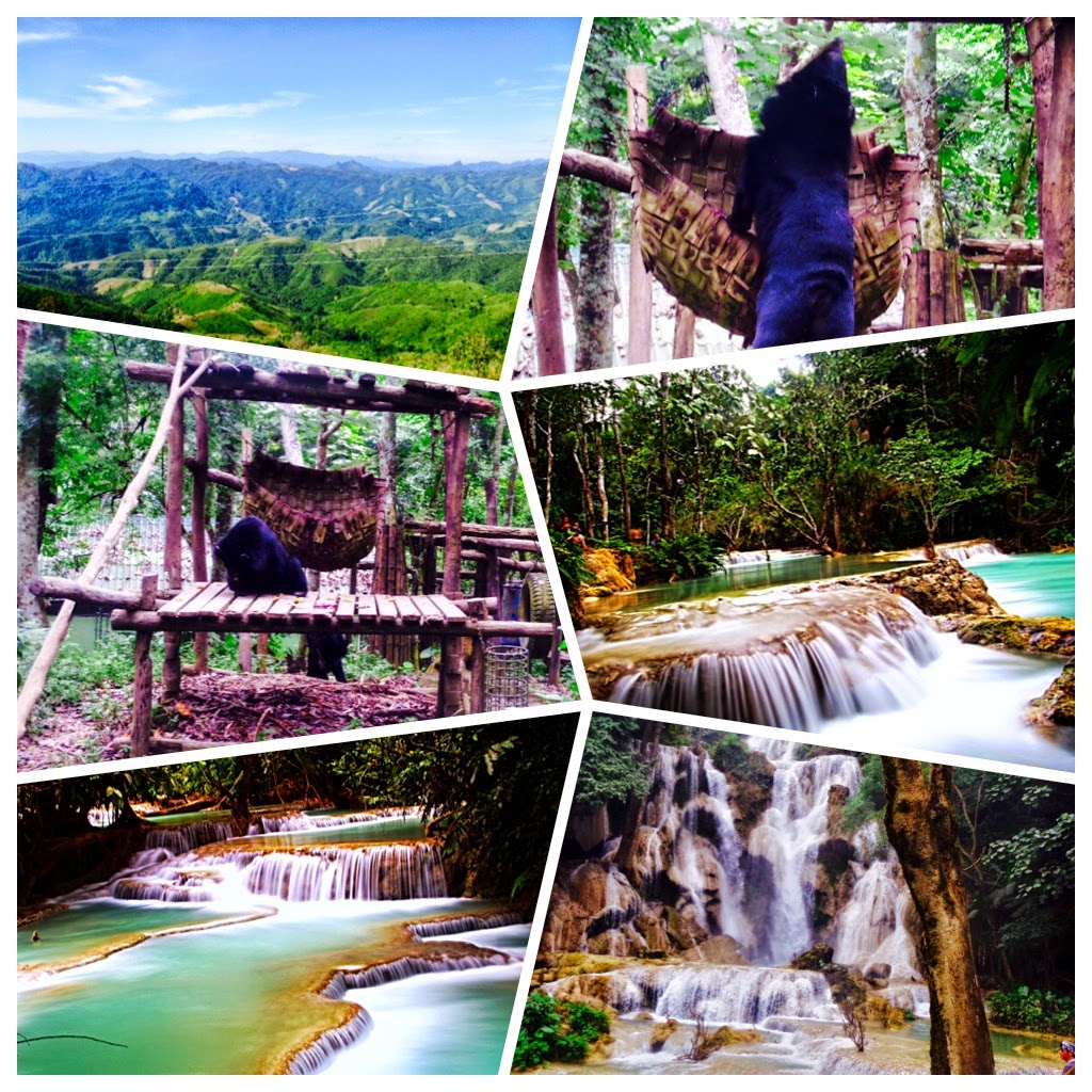
A great day for photography at Kuang Si Falls
On our second day we caught a minibus to "Kuang Si Falls". These stunning waterfalls tumble and fall down a series of pools formed from mineral deposits over many years. It's a great place to cool off with a nice swim. The place was very reminiscent of Plitvice National Park in Croatia although the size and scale of Plitvice is more impressive. Kuang Si is also home to a bear sanctuary and butterfly garden (although the latter was closed). The bears have all been rescued from illegal poachers or people that force them to dance for mostly Chinese tourists. They have a reasonable amount of space to play about in and it seems the location was chosen to aid in local public awareness. The degree of psychological and physical violence committed to these animals means that it's unlikely that these animals will ever be re-introduced into the wild, but at least they've been saved from a life of suffering.

After a relaxed and thoroughly enjoyable stay Jono and I parted ways with Ed and Dora as they went trekking further North and arranged to catch the two day slow boat to the Thai-Laos border town of Huay Xai.

11 December 2014

The Tha Khaek Loop: Unforgetable and unbelievably spectacular

20th - 26th November 2014

 Before entering Laos we had never heard about the "Tha Khaek Loop" and it was only due to advice from our dad Tony that we decided to make a stop off. It promised to be an adventure through spectacular scenery and boy did we need an adventure. We were disappointed with Savannakhet and wanted to experience "real Laos" before heading to the capital (Vientiane) and tubing (Vang Vieng) further North.

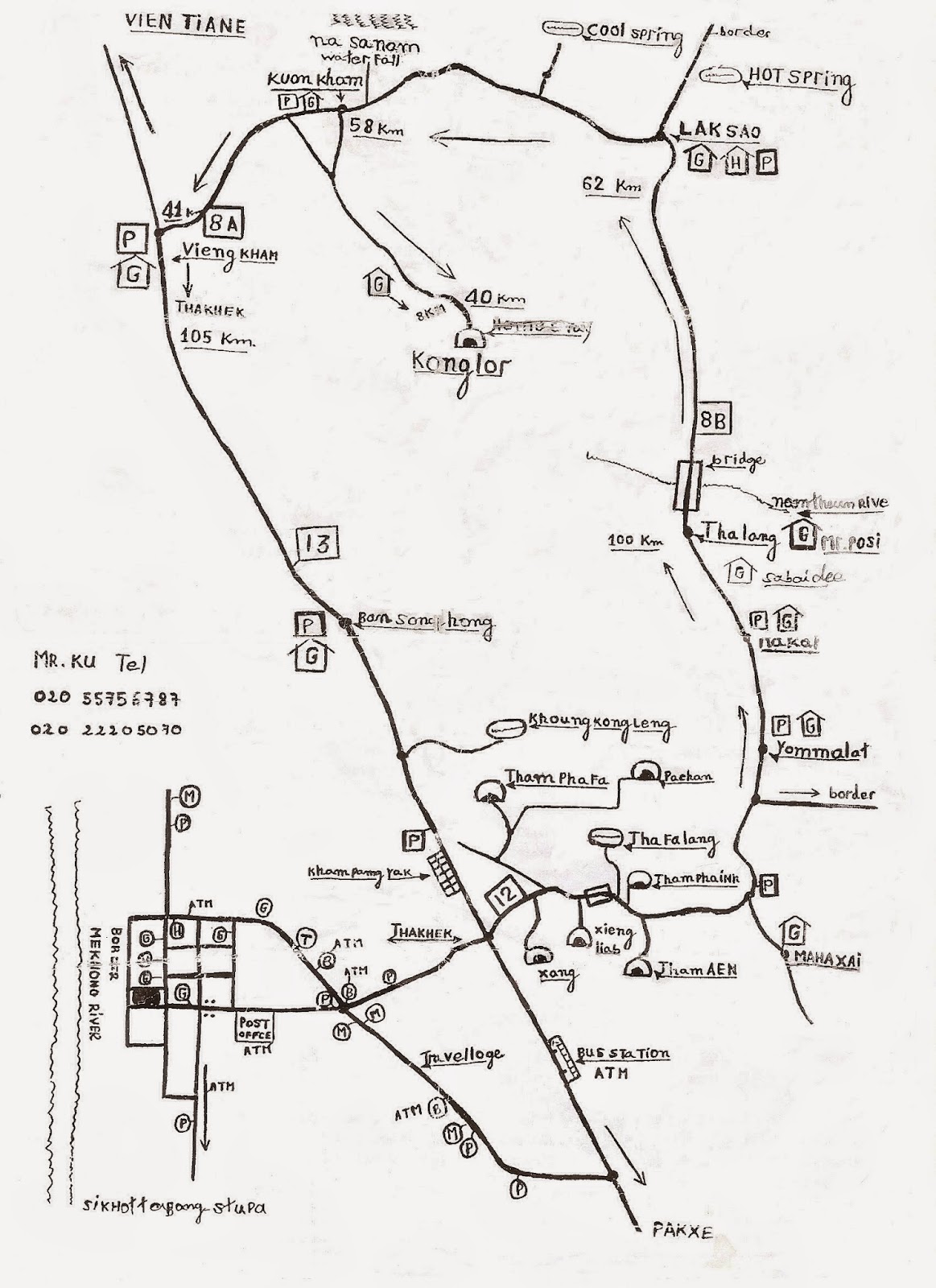
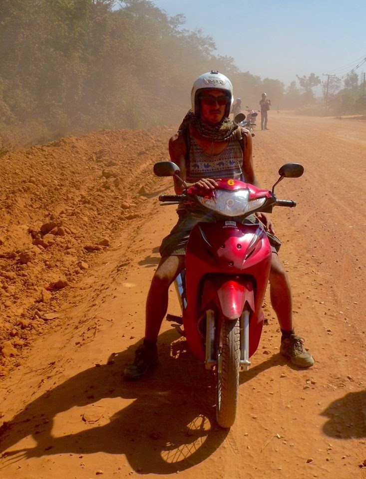
"The loop" is a 400km bike circuit starting and ending in Tha Khaek. The route passes through Phou Hi Poun National Park home to limestone mountains and impressive caves. Jono, Will and I decided to take out time and hire scooters for four days although many travellers squeeze the trip into three. Jono had ridden scooters as a teenager but for me and Will it was a trip into the unknown (I did give it a go in Vietnam but fell over so many times in a 5 meter stretch my confidence was shot).
We hired the bikes from our hostel the " Tha Khaek Travel lodge". The travel lodge is a great base for the loop with many backpackers passing through after completed or looking to start the trip. Good beds and showers allow for some comforts and a communal fire pit makes it easy to meet fellow "loopers" to arrange a convoy. The guesthouse can also store your main bags so you can travel light on the bikes.

Tha Khaek is worth a short walk around to grab supplies but no real sights. It's has a relaxed atmosphere and a few derelict French colonial buildings by the Mekong but that's about it. If your looking for a local hang out there's a beer garden near the tourist information centre. Many of the local students flock hear in the evening for a meal and beer with friends. A favourite amongst our group mostly due to the cheap prices but also because we were the only tourists, always a nice feeling.

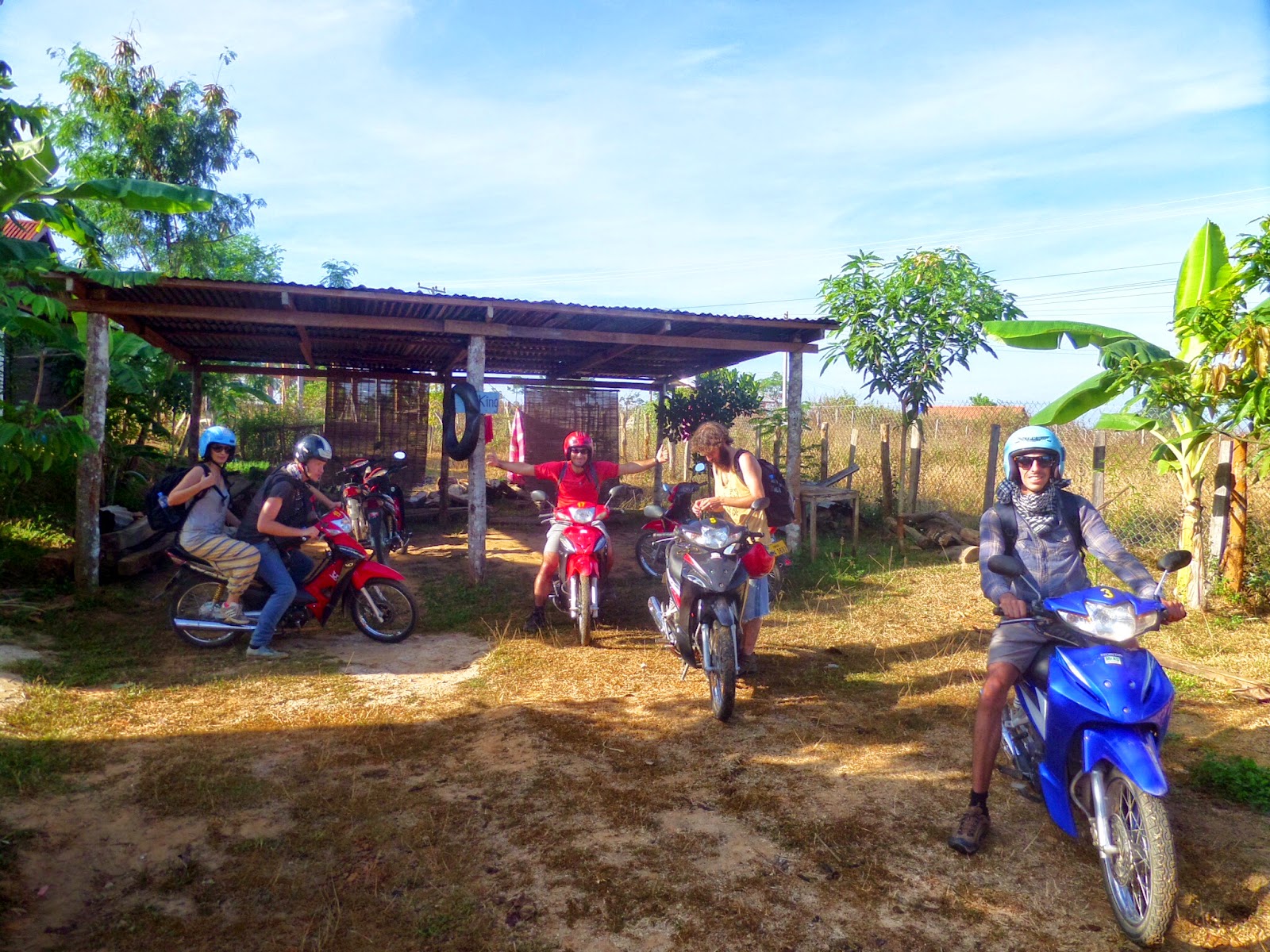
At the end of our first day (evening before our trip) Mr Ku, the hire shop owner kindly gave us a "crash" course in riding the our semi-automatic Honda Wave's 1.1cc, GTi, BNP, YMCA. After a few wobbly starts, near misses and a few attempts at riding along the main road and back we were ready. It's amazing how easy it was to make new friends at the Travel lodge and by the end of the evening our group of three increased to nine. the role call was as follows:-
Our map for the loop
Will (ENG), Aaron (U.S), Diederik (NED), Eleonora (IT), Mika (FR) and two girls from the U.S we never got to know as they didn't want to know us. Oh yes and the Bruvs with Blisters. Even though we hadn't set off on "the loop" yet there was already a sense that the journey was going to be a good one. 9 companions from different countries and cultures joining forces in a region of short folk to complete an epic adventure. It's was like Lord of the Rings but better.

We started with nine "loopers"
Day 1:
We headed out at around 10am and were required to ride 160km East along highway 12 and North on highway 8B to the village of Thalang where our first guesthouse was located. Along the way we could visit five caves Tham Pha Pa, Xieng Liab, Tha Falang, Tham Phainh and Tham Aen.
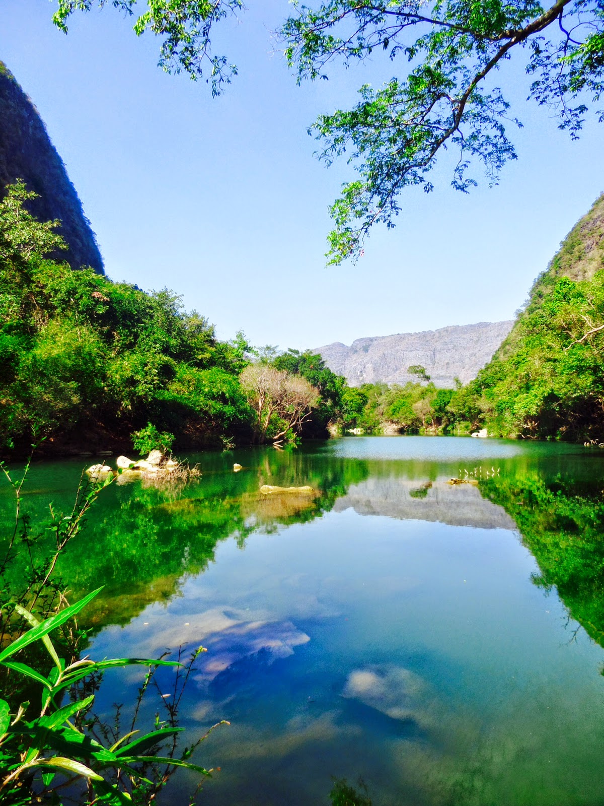
Tham Pha Pa also known as the "Buddha Cave" is located a few kilometres out of Tha Khaek (first left after the sign to Xang cave) at the end of a 2 km dirt track. This was our first real opportunity to practice some off road riding and we all took it quite tentatively at first. Riding the Tha Khaek loop in November was a stroke of coincidence as I imagine this track would have been very tough during monsoon season. All in all we had great fun avoiding pot holes, undertaking lorries, avoiding bush fires and waving at the locals. The cave itself is surrounded by amazing karst mountains and turquoise lakes. It's not the biggest cave in the world but the discovery of hundred of Buddha statues left for hundreds of years makes it the most peculiar. The mystery of why this cave was chosen to house such sacred figures adds to local superstitions and the place remains a sight of worship and prayer for locals.

The base of the Buddha Cave
Once back on highway twelve it wasn't long until we reached our second stop and cave Xieng Liab (just before the large bridge. Pull into a small lay-by by wooden huts). It's pretty easy to miss this stop as the sign posts are not clear but after stopping by the bridge we were welcomed by a local Laotian who offered to look after the bikes and show us to the cave. As dodgy as this sounds it's
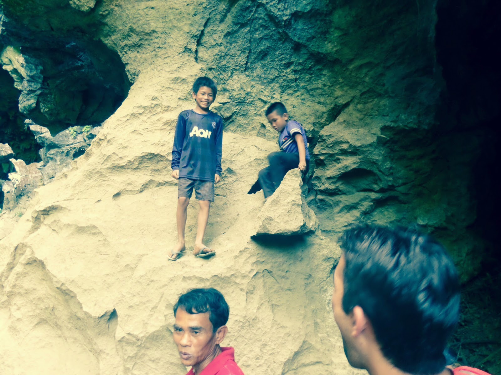
totally legitimate as if your unsure just ring back to Mr Ku and double check. For a small fee the local chap and his two sons enthusiastically gave us a guided tour of Xieng Liab. Much larger than the Buddha cave, Xieng Liab allows visitors to wander through the base of a small limestone outcrop. There are impressive stalagmites and stalagmites and after a warm ride it just pleasant bathing your sweaty feet in the cool stream.
Our guides to Xieng Liab Cave
Entrance to Xieng Liab Cave
1km East of Xieng Liab is the dirt track to Tha Falang cave (first left after the bridge). It's only half a kilometre drive and if you like its a ten minute walk from the previous cave so you can just leave your bikes with the local guy. Tha Falang is a welcome swimming spot as the submerged cave system has formed a beautiful turquoise pool. There's no cave to walk around so a short stop to chill out is all you need. By the time we left the third stop it was 1:00pm which was the time Mr Ku had advised we should start thinking about heading to the guesthouse. This sadly meant that we had to miss the fourth cave at Tham Phainh and head straight for the final stop. It was at this point That the two American girls decided to leave us. It was their first time riding and as they were committed to three days were concerned about making it to the guesthouse in time. So our group of 9 became 7.

The lagoon at Tha Falang Cave
Tham Aen is located around 8km East of the Tha Falang turning and is clearly sign posted for  "loopers". As with the Buddha cave there is a small entrance fee but it's well worth it. This large cave is ideal for walking around with concrete stairways that blend in nicely with the surrounding rock. If you squint it's reminiscent of M.C Escher's lithograph print "Relativity".
It supposedly takes 5-6 hours to ride to Thalang. It's a good 120km, but we absolutely blitzed it, completing the trip in 3 hours. Highway 12 was not too busy and a fun drive through karst foot hills and peaceful rice paddies. The only dodgy thing was the truck convoys transporting cement and other aggregates. They normally have a lead van with warning lights (if they feel like turning them on) which is shortly tailed by three or four lorries. All vehicles hog both sides of the road, drive as fast as they can and don't seem to slow down for anyone or anything. This probably explains why over the course of four days we saw many accidents involving trucks. I personally was just happy to give the guys space and let them pass, which is weird coming from an ex-white van man.

Tham Aen Cave
Once you pass through the small town of Gnommalet you bear left onto highway 8B and possibly one of the best stretches of roads on the trip. The roads in pretty good condition and follows the course of an adjacent river until you cross at a recently constructed hydro electric plant. Immediately after the dam it's an abrupt climb through the karst tundra rising a few hundred meters which allow for an amazing view of the surrounding landscape.
Our group continued to follow the lake formed by the dam until we arrived at Sabaidee Guesthouse in Thalang at around 6pm. It was a long but thoroughly enjoyable day and we were pumped for the second leg.

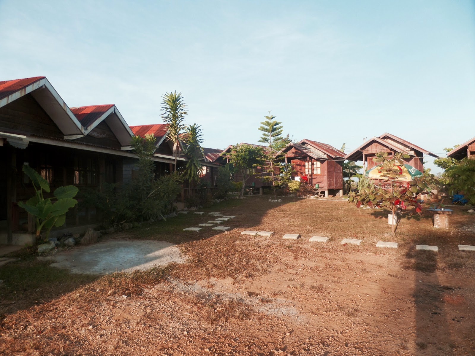
Sabaidee was a travellers oasis. Wooden huts housed large dorms or private bungalows. The owners provided a wonderful all you can eat BBQ around a communal campfire. They even made their own pain au chocolat. What more do you need. Over the fire and many Beer Laos we talked of travels, experiences and made jokes well into the night. There were other travellers at the lodge some loopers, others doing their own thing. There was a Swiss guy in his mid 60's who had retired and travelled all over the world on a shoestring for 6 years and a funny Russian chap attempting to cycle around Asia. His English was limited so the few Russian phrases we learnt on our travels came in handy although it was hard to escape the fact that he sounded a little bit like Borat. At one stage he made a joke about cannibalism that only he found funny but the way he laughed was infectious enough to have everyone in hysterics.

Sabaidee Guesthouse
Lake view before Thalang
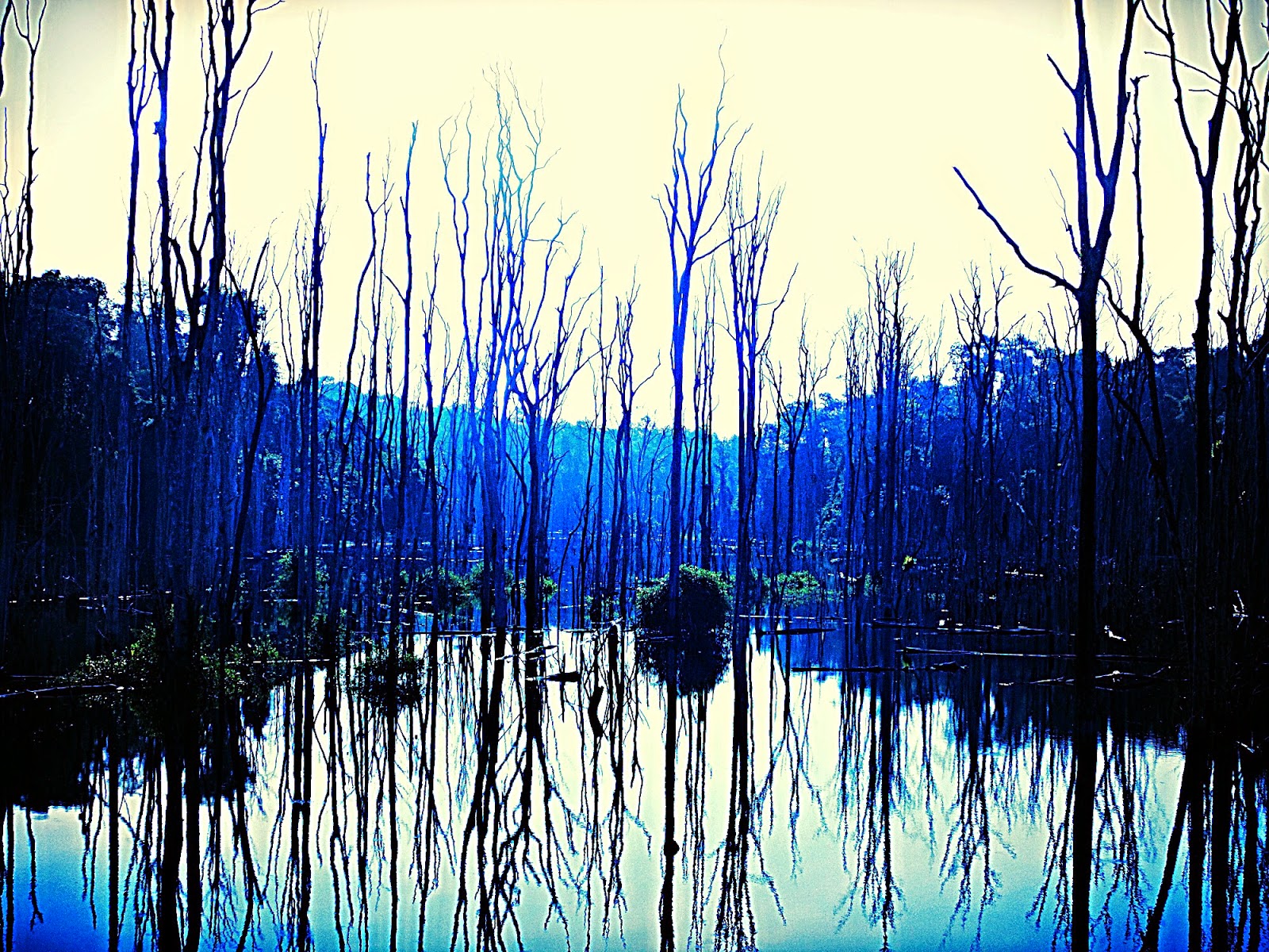
Day 2: Jono, Will and Aaron woke early to check out the sunrise. The landscape created by the dam was pretty unique. The rapid change from woodland to lakeland has produced a solemn but strangely beautiful forest of dead tree trunks. It's something I remember studying in a geography classroom asa teenager but had never experienced first hand until now. The whole landscape emphasises the fact that although new energy projects improve the some living conditions for locals. Environmental and social impacts for the immediate area are often considered but overlooked. It only left me wondering how many villagers have had to relocate to make way for government plans and Chinese developers and how much compensation they received, I'm guessing very little if any.

Heading out for another day on the road
The impact of the dam downriver
 As we left  Thalang there were two noticeable changes. The first being the size of our group which had dropped to six as Mika had to leave early and the second was the road condition. The smooth tarmac abruptly vanished and left only trodden dirt and dust. The rust coloured sediment became a slight irritation especially when the trucks and 4x4's bombed passed. The pot holes got larger and the sand deeper as the trail twisted and turned on its steady incline up to a plateau and back down towards the river again. It was a harder 62km ride that left you with a sore arse but great fun, especially when passing through the villages. It's always amazing how friendly the children are in South-East Asia. Despite relative poverty and hardships they would all be outside their homes shouting "Hello" or "Sabaidee"as soon as our group rolled into view. We'd often stop to offer snacks as a thank you and it only made the experience more enjoyable. I think if you tried that back in the UK you'd be pelted with eggs or put on a dodgy register.

The Rough Riders
I became one with the road or the same colour at least
 After the dirt track was the town of Laksao. This is the junction point between highways 8A and 8B and where we decided to pull over to recalculate our progress.
Most loopers never stop at Laksao and keep pressing on toward Kuon Kham where our second guesthouse would be. Our rest stop was rewarded when Diederik was ushered into a locals house where they were throwing what turned out to be a house warming party. We were immediately all invited to take a seat as a banquet of Laos dishes was presented to our two small tables. We were accompanied by three Laos guys, one who couldn't hardly stand up due to his intake of Laos Laos whiskey, one who spoke good enough English to explain what was going on and a third who apparently was a local police chief. The pissed guy spent the whole time shouting something and forcing whiskey into our hands. Eleonora seemed to bear the brunt of this treatment as the chap seemed intent to get the only female member of our group as drunk as possible. It was a great experience and one we were all thoroughly grateful for. We ate, we drank, we danced until tipsy and then waved goodbye and hopped back on the bikes. Even the police chief didn't mind us drink driving, possibly because he was more drunk than we were and also due to the fact his shift didn't start for another two hours. It was great to be part of an authentic Laos celebration and experience first hand their kind generosity. The guy who owned the house waved away any approach we made to pay him for his kindness, emphasising the countries stance on common curtesy.

Laos house warming party
Our loopy band now merry on food and spirits headed west on highway 8A towards Kuon Kham. The 58km stretch was much smoother than our morning ride and we made good progress through mixed karst terrain. Flat open farmland led onto steeper more treacherous mountain passes. Once again we saw first hand what the Laos driving style of overtaking three vehicles on blind turns leads too when as we passed numerous accident sites. One resulting in a truck flipping upside-down (I still can't figure out how but the driver managed it), however the tighter passes that hinder the larger vehicles only benefitted our choice of vehicle. The Honda Waves Jono, Will and I had hired were well suited for the task at hand and never showed any signs of breaking down. Aaron and Diederik were left with the Zhongshan Waves which were a little less powerful and seemed to run out of fuel twice as quickly as the Honda. A shining example of Chinese efficiency if you ask me.

Aaron enjoying Highway 8A
A detour off Highway 8A 
If you get thirsty or run out of fuel along the loop there are many shacks selling all the basic supplies from even the most remote locations. As a friendly warning though make sure the water is water. I stupidly believed a local and purchased three small bottles of clear fluid thinking it was water which turned out to be whiskey. Hilariously Diedrik unknowingly offered some to Eleonora who was looking for water to wash out a leg burn caused by the bike exhaust. No doubt it cleansed the wound but it must have stung like a bitch.

Na Sanam Falls
Na Sanam Falls
Na Sanam Falls
Despite the house party we made it to our second guesthouse ahead of schedule so decided to take a detour and visit Na Sanam Falls a day early. After a five minute ride off-road and a ten minute hike we reached the falls just as the day was coming to an end. Once again the landscape remained a stunning spectacle. The large twin waterfall plunges from a rock shelf surrounded by jungle. A fitting end to day 2.

7 December 2014

Champasak: Wat a cracker

14th - 16th November 2014

View from the Mekong 
Will "the cabin boy" Dadson
It took two ferry crossings and a short bus journey to get from Don Det in the 4000 islands to Champasak.

Champasak is a great pit stop for anyone heading north or south along the main tourist track. It's position on the Eastern bank of the Mekong means that it's isolated from the main highway and provides peaceful places to relax and listen to the steady churn of the river.

Jono storming ahead
Lakes at the entrance 
Wat Phu from the main path
Bit of a climb to the top 
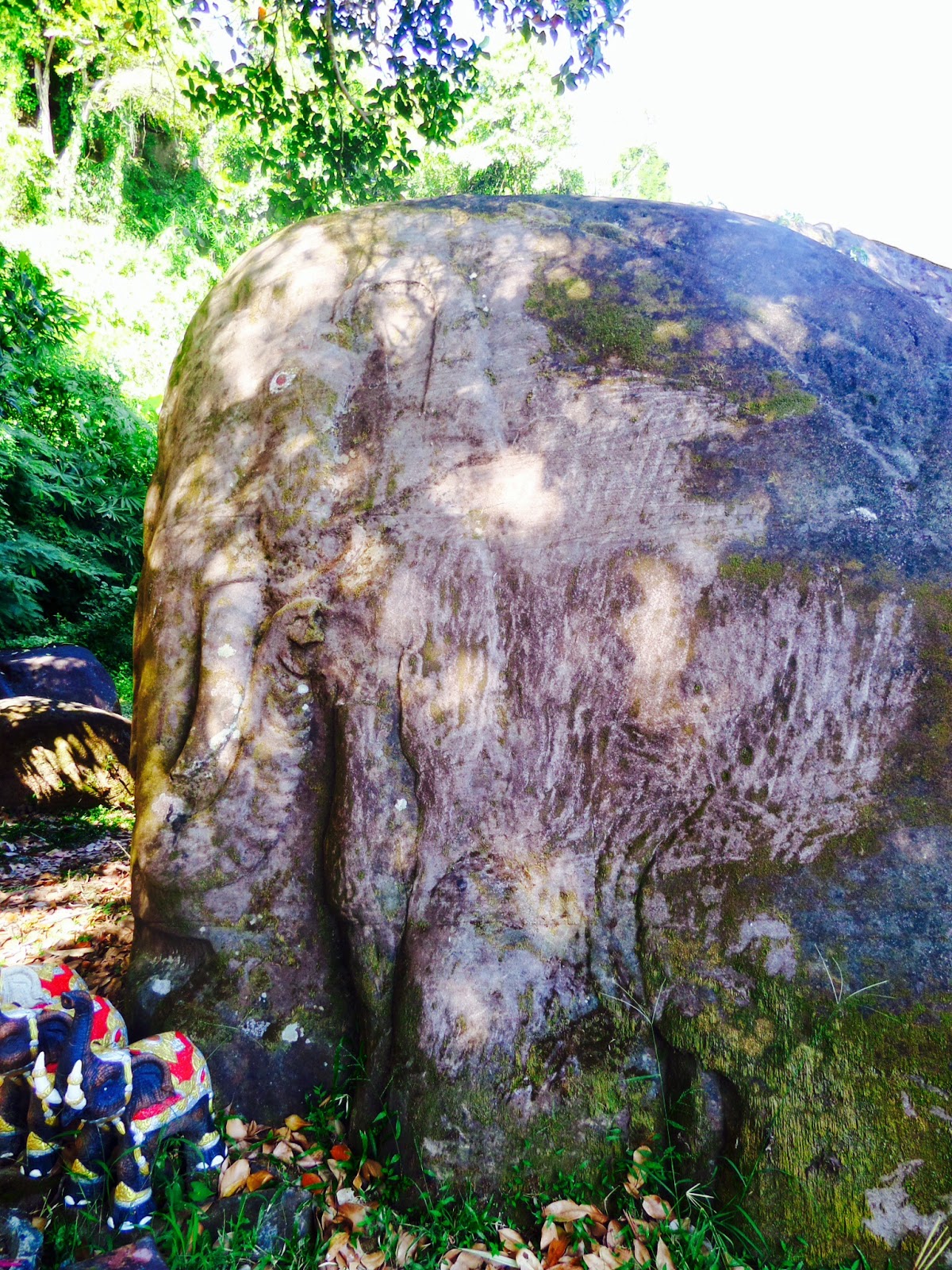
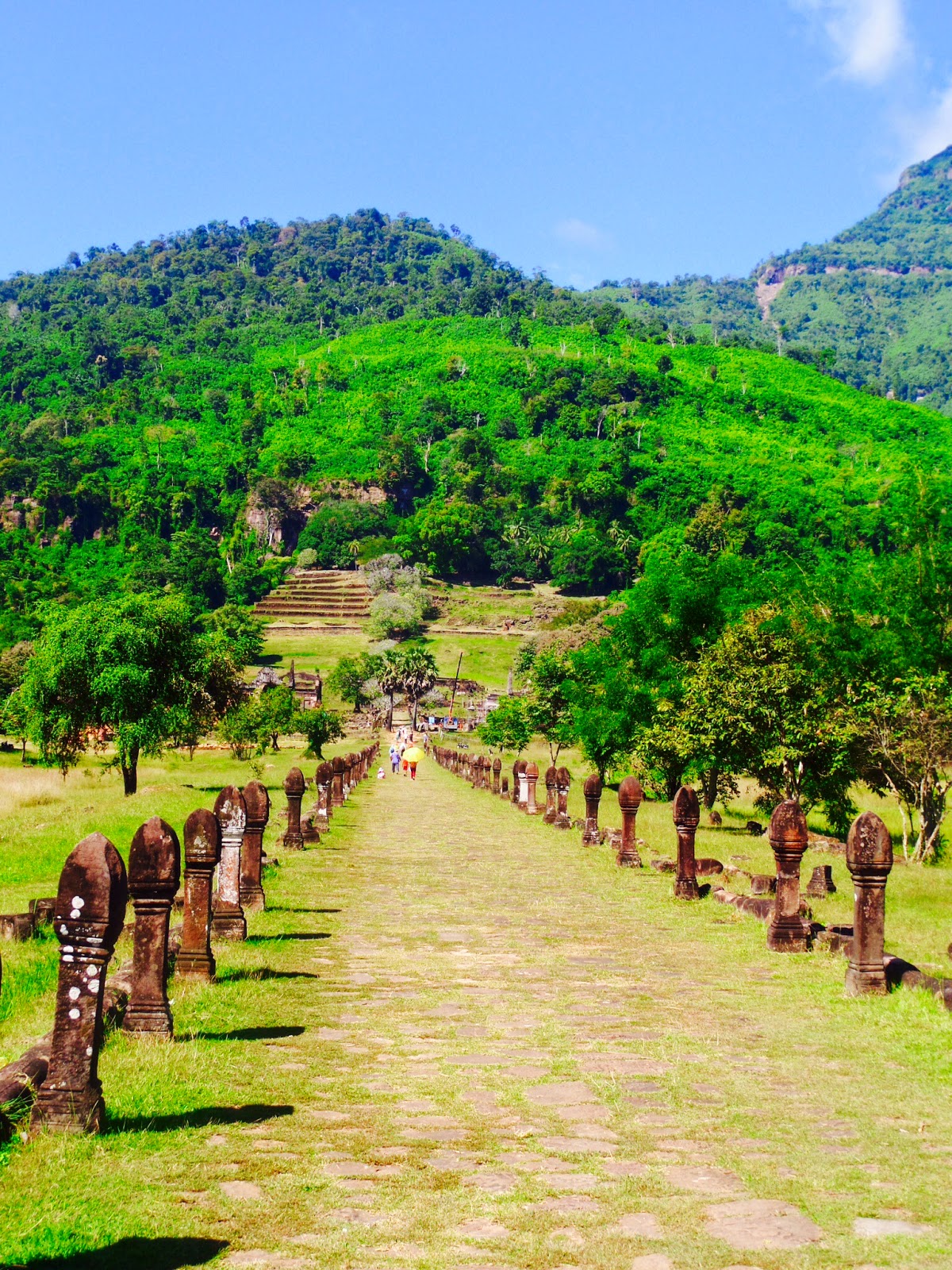
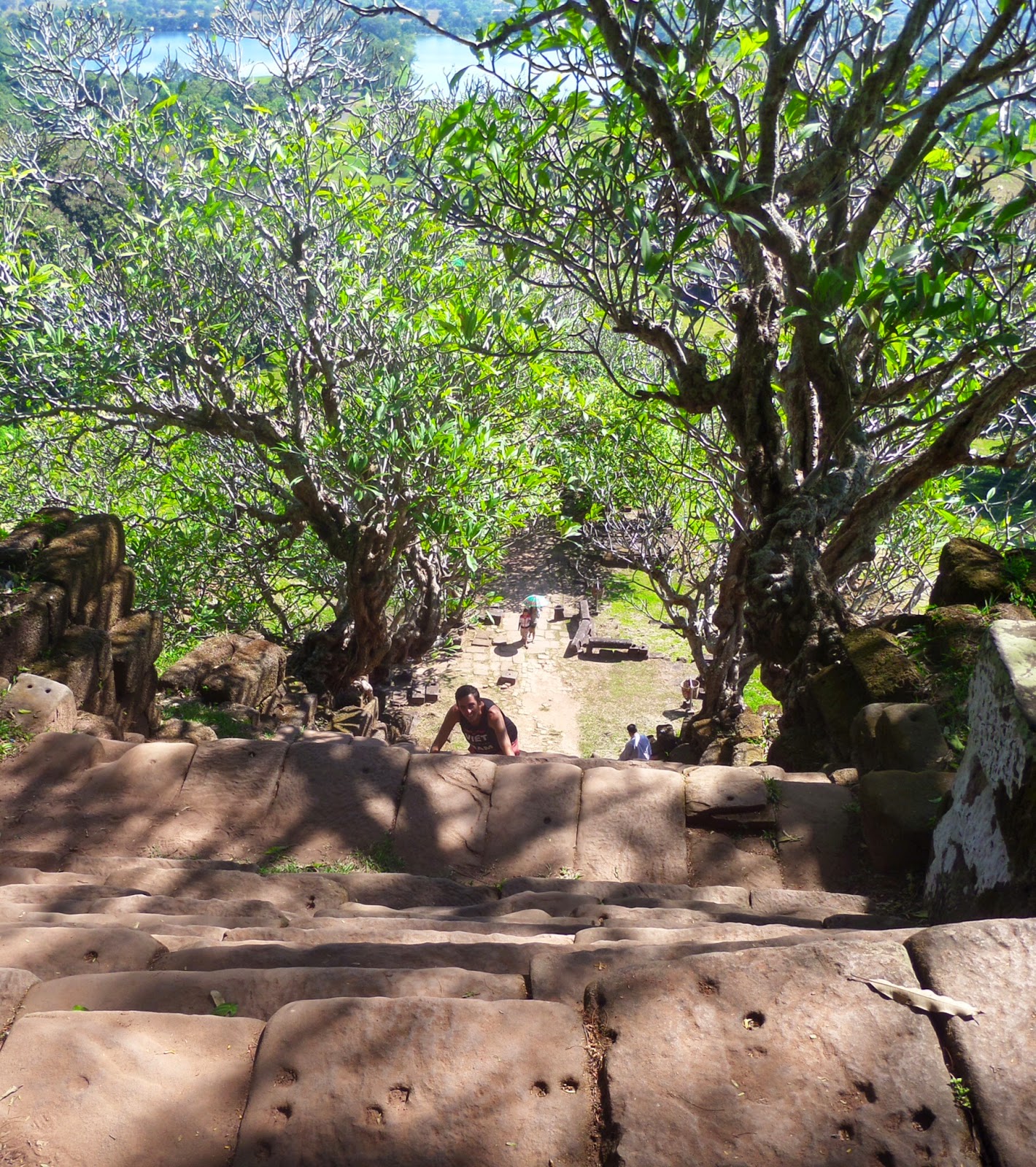
There's only one true sight close to Champasak, Wat Phu. Like the Temples we visited around Siem Reap, Wat Phu was constructed during the rule of the Khmer Empire. The temple is by no means in as pristine condition as Angkor Wat with crumbling walls and eroded carvings. However unlike its Cambodian neighbours Wat Phu is still an active worship sight and it's elevated, dominant position offers stunning views of the surrounding fertile floodplain sand the Mekong beyond. Wat Phu also boasts two unique animal themed stones. The elephant and crocodile stones take a little bit of searching to locate and I do think the locals embellished the grandeur of these artefacts a little. Check out the pics .......impressive eh.

The Elephant Stone. Nice eh
The Crocodile Stone. Wow!

Whilst walking around Champasak on our first evening we were informed by a Frenchman working in the area that the local community hall performs a traditional shadow puppet theatre every Tuesday, Wednesday, Friday and Saturday. As the pubs aren't open late we opted to check it out.
We had seen a performance at the water puppet theatre in Hanoi two months ago and despite the immediate lack of facilities and funding the locals did an incredibly good job (although I have to admit Jono and I did fall asleep a few times. Only because we were so enveloped in the plot, promise). A ticket cost 50,000 kip (£4.10) and all the proceeds are pumped back into funding the community centre. It must be noted that the show is obviously performed in Laos and information sheets are displayed explaining the plot although only in French. In my opinion this made it more fun as you can fill in the plot gaps yourself.

Next stop Pakse!

4 December 2014

Been there Don Det

10th Nov - 15th Nov 2014


Been there Don Det........ but first a B***ard at the border to deal with!


As we left Banlung to cross into the 22nd country of our journey it's fair to say we considered ourselves seasoned seasoned "border crossers" used to the inevitable delays, confusion and of course the possibility that a crumbled up multivitamin tablet might be considered a class A drug. However nothing we've experienced so far compared to the Cambodia/Laos border.

At first glance it seemed like a pretty straight forward itinary. We would catch a minibus from Banlung to Stung Treng and from there we would await another minibus to transport us to the border where a third bus would complete the trip to the ferry port for Don Det. As the crow flys it's a journey no longer than 150km or so.....straight forward right. Maybe in Europe but not in Asia. In total the journey took us around 12 hours (we were quoted 6).
Now I know what some of you are thinking. "Oh well you are in a very poor part of Asia with poor infrastructure and so on and so on" and yes we do understand that when they say 6 hours for a journey it will normally take 8 and yes your four seat row will contain five people and three different kinds of livestock. We also accept that the chassis of the van will be held together by chewing gum and the prayers of all on board, but the most infuriating thing for us is being made to look like fools by the only knob head in Cambodia. Sadly all we can do now is ensure nobody else is made to look like a fool.

Firstly if you arrive at the border (in our case it was late in the day close to closing time) you will pull alongside a small restaurant shack. A Cambodian man will greet you (to help the story I'm going to call him Mr Unt) and ask you all to quickly follow him as so you can fill out the relevant forms. Mr Unt will also divulge you in a merry tale of how if you give the form and passport to him he will kindly process them "very quickly". However if you attempt to cross the border yourself you could get stuck in "No Mans Land". Mr Unt will also show you a piece of paper with the latest visa fees and he will pass your money onto the desk for you.

Basically all you need to know is that Mr Unt no matter how much he claims to know is only experienced in two things "bullshitting and robbing tourists". W payed $45 dollars to cross with Mr Unt and if you don't have a passport photo you somehow pay $5 more. To add insult to injury Mr Unt took two hours to process the passports "very quickly" at which point we then walked across an unmanned border and waited another 45 minutes for our bus to turn up.
A German couple made the very wise decision to ignore Mr Unt and payed half the price.

I hope this information helps anyone looking to make the same trip and as a final tip if you travel on a weekday like us you pay less than on A Saturday or Sunday. Worth remembering.

Rant Over.....